
📊 Full opportunity report: The City That Watches Itself: The Living Digital Twin, and the God’s-Eye View We’re Building on ThorstenMeyerAI.com — validation score, market gap, and execution plan.

Get business pricing on monitors, keyboards and dev gear
- Business-only prices and quantity discounts
- Tax-exempt purchasing
- Multiple users, one account, clear invoices
TL;DR
Cities are increasingly building real-time digital twins, combining sensors, satellite data, and AI to monitor urban environments continuously. This development enhances planning but raises significant surveillance concerns.
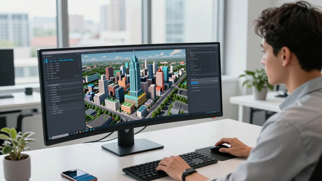
City officials and tech developers are now deploying advanced digital twins that monitor urban environments in real time, combining sensor data, satellite imagery, and artificial intelligence. This innovation transforms static city models into living, responsive systems capable of detailed observation and simulation, raising both opportunities for better urban planning and concerns about surveillance and sovereignty.
The core of this development is the integration of wide-area motion imagery (WAMI), all-weather radar, satellite data, and frontier AI models capable of understanding complex data streams. These systems enable cities to continuously track vehicle movements, pedestrian flows, and infrastructure status, creating a dynamic, rewindable record of urban life. Cities like Singapore, Helsinki, and Las Vegas have already implemented versions of these digital twins for operational use, such as optimizing traffic flow and infrastructure management, resulting in significant cost savings and efficiency gains.
The key technological breakthrough is the recent advancement in AI, which now allows machines to fuse heterogeneous data types, recognize behavioral patterns, and process natural language queries. This means city officials can ask complex questions like “Where did this vehicle go last Tuesday?” or simulate emergency scenarios in real time. However, this capability also introduces risks, including potential misuse for mass surveillance and loss of sovereignty, especially if such systems are operated by foreign entities or controlled through external AI platforms.
The city that watches itself: the living digital twin, and the god’s-eye view we’re building
Soon most cities will exist twice — once in concrete, once as a live data model you can rewind, simulate, and question in plain language. Persistent sensing + frontier AI turn the planner’s digital twin into an oracle. The most useful thing we’ve built — and the most powerful surveillance instrument. Both at once.
- Plan better — cities & rural: traffic, zoning, energy, land use
- Emergency response — route crews, one live picture, ~50% faster
- Disaster resilience — simulate, track live, assess damage in hours
- Mass surveillance — track everyone, retroactively, forever
- Pattern-of-life — AI links movements, infers associations
- Social control — no warrant, no suspicion (cf. Baltimore, 2021 ruling)
We’re building a city that watches itself, remembers everything, and can be asked anything. The technology won’t choose between saving lives and ending privacy — we will, through the rules we write now, while the twin is still under construction and the defaults haven’t yet hardened into permanence. WAMI and the living twin open our lives to a view from the heavens that, from the dawn of civilization until a heartbeat ago, was reserved for gods and stars. The question is no longer whether we can see everything — it’s who gets to look, and who watches the watchers.
Implications of Self-Monitoring Urban Systems
This technological shift could revolutionize urban management, enabling more efficient planning, disaster response, and resource allocation. Cities can anticipate problems before they escalate, reduce infrastructure costs, and improve quality of life. However, the same systems also pose serious privacy and security concerns, as they effectively create a comprehensive surveillance network capable of tracking individual movements and behaviors in real time. The potential for misuse or external control underscores the importance of sovereignty and data governance in deploying these technologies.
As an affiliate, we earn on qualifying purchases.
Evolution of Digital Twin and Sensor Technologies
The concept of digital twins originated as static models used for planning and simulation. Over the past decade, cities like Singapore and Helsinki have developed operational twins that integrate GIS, IoT sensors, and utility data for real-time management. The recent leap comes from the integration of WAMI sensors and advanced AI, which enable continuous, detailed observation and analysis of urban activity. This convergence of technologies has matured rapidly in 2023, driven by breakthroughs in AI understanding and multi-sensor fusion, transforming the twin into a comprehensive, living urban brain.
“We are witnessing the emergence of cities that not only plan themselves but also observe and adapt in real time, thanks to the convergence of sensors and AI.”
— Thorsten Meyer, AI researcher
real-time city sensor monitoring devices
As an affiliate, we earn on qualifying purchases.
As an affiliate, we earn on qualifying purchases.
Unresolved Concerns and Risks of Digital Twins
It remains unclear how widespread adoption will be, especially regarding data privacy, security, and sovereignty. The potential for external control or misuse of these systems is a significant concern, and regulatory frameworks are still evolving. Details about how cities will balance operational benefits with privacy protections are still emerging, and the long-term implications are uncertain.
As an affiliate, we earn on qualifying purchases.
Next Steps in Urban Digital Twin Development
Expect further integration of AI capabilities, including more sophisticated natural language querying and predictive modeling. Cities are likely to expand the scope of their digital twins to rural and environmental monitoring, while policymakers will need to address privacy, security, and sovereignty issues. Ongoing discussions at international levels may influence regulations and standards for these systems in the coming years.
As an affiliate, we earn on qualifying purchases.
Key Questions
How do digital twins improve city planning?
They allow planners to simulate changes, analyze impacts before implementation, and optimize resource use, leading to cost savings and better urban design.
What are the main privacy concerns with these systems?
They can track individual movements and behaviors in real time, raising risks of mass surveillance and misuse if not properly regulated.
Are these digital twins controlled locally or externally?
It varies; some cities operate their own systems, while others may rely on external providers, raising sovereignty and security questions.
Can these systems be hacked or manipulated?
Yes, as with any complex digital infrastructure, they are vulnerable to cyberattacks, which underscores the need for robust security measures.
What is the timeline for wider adoption?
While some cities are already using these systems, broader adoption depends on technological, regulatory, and political factors, likely accelerating in the next 5-10 years.
Source: ThorstenMeyerAI.com
Columbus Day / Indigenous Peoples' Day Picks
long weekend sales
As an affiliate, we earn on qualifying purchases.